The 1978 Naga town plan
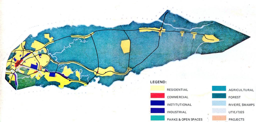 AFTER patiently explaining to Job Oliva, statistician of the city planning office, what I wanted, we finally found yesterday the information I was looking for: the 1978 town plan of the city in the form of two maps.
The maps were already in a state of decay, which does not speak well of how we handle information of high institutional, not to mention historical value. It's a picture of what the city wanted itself to be three decades ago, for chrissake!
Fortunately, technology (our HP scanner, plus Adobe Photoshop CS, Microsoft Paint and Microsoft Office Picture Manager) came to the rescue. Restoration is still a work in progress, and I'll be asking Mike, our ever dependable graphics artist, to spare some time in doing a better digital restoration effort.
But for the meantime here they are, available for comparison with the 2000 land use plan, as well as how Naga has developed spatially in the last 28 years, via Google Earth.
![]()


0 comments:
Post a Comment