In the eye of the storm, literally
 MY VILLAGEMATE and former city hall colleague Senen Ebio prompted me with this most interesting map here. It's a consolidated history of the typhoon paths over the last 50 years in the Asia-Pacific region, courtesy of the UN Office for the Coordination of Humanitarian Affairs (OCHA).
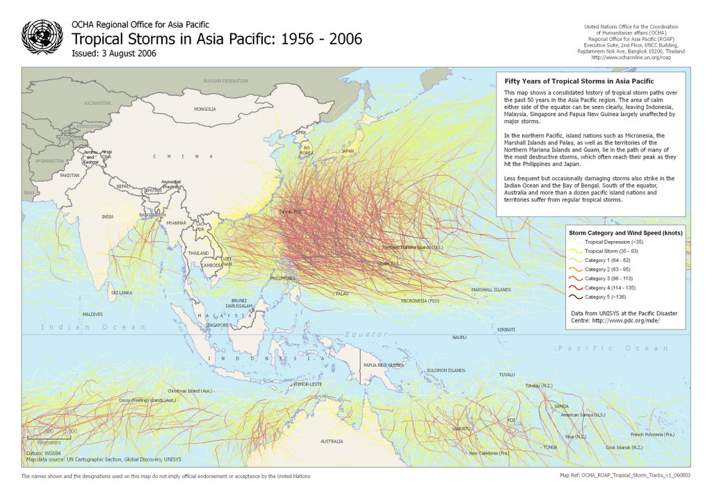
Now I realize why the Philippines has bore the brunt of nature's worst disasters: together with Taiwan and Japan, it practically shields mainland Asia like some sort of a French Maginot Line for the most part--with the exception of some that manage to cut their way through.
And why Mindanao is relatively safe and its people largely unaware of these tempests--like when its delegates during a national DepEd contest in 2004 here cheered when howling winds of Typhoon Yoyong severed the rooftop of the Naga City Sports Complex and sent it flying near their billeting center at the Camarines Sur National High School.
I believe though that recent climactic shifts have occurred, probably due to the El Niño/La Niña phenomenon, as Bicol is no longer brutally punished by these annual visitations as in the past. In fact, I remember the typhoons of my youth twisting with ease the Napocor (now Transco) transmission towers connecting Tiwi to the Luzon grid--something Milenyo for all its damage wrought failed to do.
It will be most interesting to test my thesis with visual typhoon maps aggregated by year, or even every 5 years. I hope OCHA can also make these available online.
![]()


0 comments:
Post a Comment