Off to Cagayan Valley
 WORK WILL bring me to Cagayan Valley (Region II) via Tuguegarao over the next two days, so my posts will depend on whether I can access a computer with internet connection.
In preparation, I checked the region on Google Earth, spurred partly by Urbano's latest post about better high-resolution imagery already available for Metro Manila. Immediately, the dominant geographic feature that seized me, because it is strangely familiar, is the mighty Rio Grande de Cagayan or simply Cagayan River. According to Wikipedia, it is the biggest and longest river system in the country.
Strangely familiar because mainland Bicol is also dominated by the Bicol River (which I traced in orange line using Adobe Photoshop to make it more visible) and its tributaries (including our very own Naga River), which drains the fertile river basin quite visible from the map. In fact, the name Bicol stems from "biko," which means "crooked" in the native tongue -- most apt for this meandering system that is fed by Lakes Bato and Baao, snakes through Bula and Minalabac, and then Naga, Milaor, and San Fernando, before dumping its waters into the Pacific via the Libmanan-Cabusao area.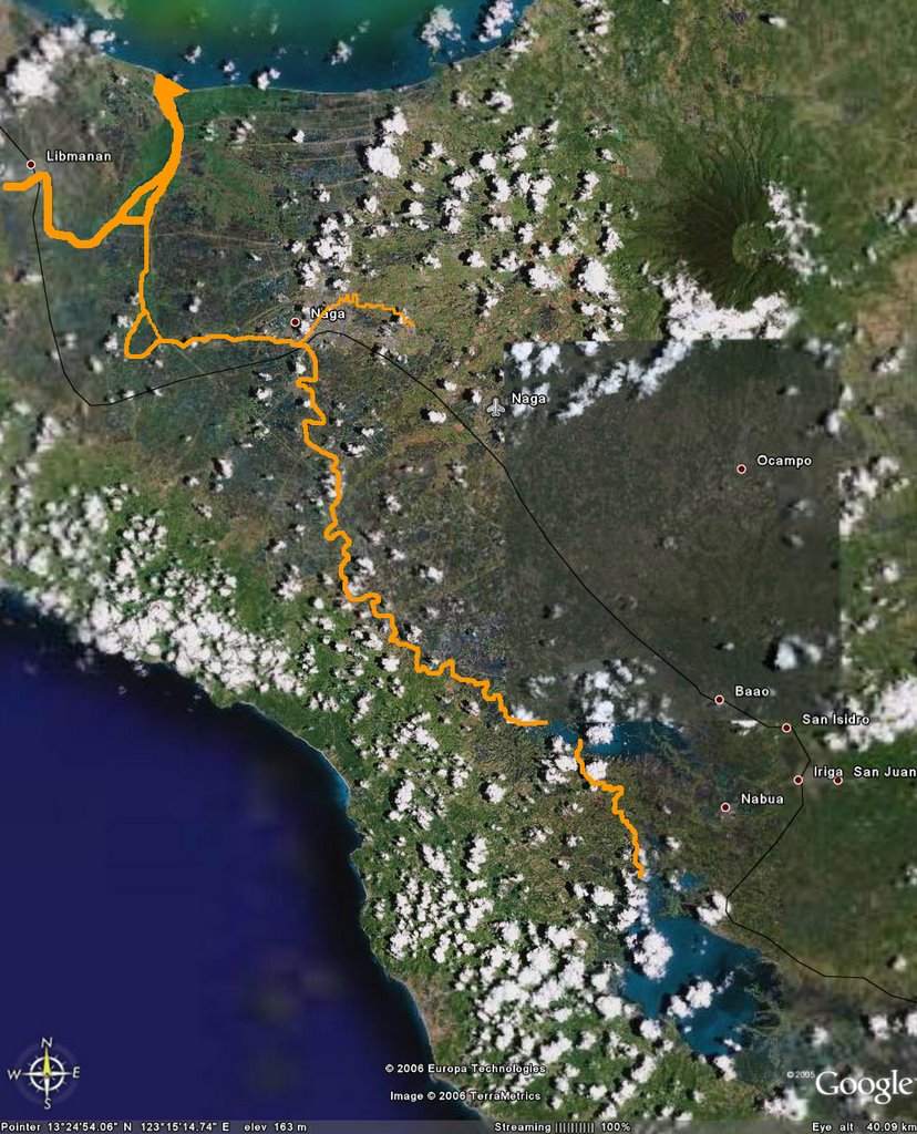 This is the setting for the exploits of Baltog, Bantong and Handiong, the trinity of ancient Bikolano heroes in the prehistoric Ibalon, the de facto title of our own incomplete regional epic written by Kadugnung. Abdon Balde, Jr., who penned this most interesting article at Oragon Republic, outlines what it will take to add the missing pieces.
Thanks to Google Earth, we can now visualize what remains of it, before Bicol River -- as with many other river systems in the country -- was sidelined by modernity. In the map, it is represented by the slim black line: the Pan Philippine Highway which is now the main artery connecting the present urban settlements that we know of today.
![]()


2 comments:
"...slim black line: the Pan Philippine Highway..."
Riles yan.
Oops, I think you're right, and I stand corrected. Indeed its the PNR railways since it passes through Iriga, which the Pan-Philippine Highway skipped.
Post a Comment